boletin snit edición nº 5
DESCRIPTION
Información TerritorialTRANSCRIPT
Snit
1
Expertosinternacionalesexponen en Chile
La Información Territorial enel contexto de e-Governmenty su importancia en eldesarrollo de las Naciones
Catálogo SNIT:Herramientas paraconocer y evaluarla informaciónterritorial existenteen el país
Chile y laInfraestructuraGlobal de DatosGeoespaciales
Red SIT Coquimbo“Una apuesta regional,para el desarrolloLocal”
El ProyectoMapa Global
2
Cumpliendo con las instrucciones presidenciales,el año 2003 se realizó un importante avance entodo lo relativo a crear el Sistema Nacional de In-
formación Territorial, al elaborar una propuesta de Políticade Estado para la Gestión Moderna de la Información Terri-torial en Chile. En este esfuerzo participaron las institucio-nes públicas que se coordinan a través del proyecto SNIT,incluyendo ministerios, servicios y gobiernos regionales.También se contó con el aporte de instituciones que no de-penden de la administración central del Poder Ejecutivo, asícomo de instituciones de la sociedad civil, las que se agru-paron en el Comité Consultivo de apoyo al proyecto (Sena-do, Cámara de Diputados, Biblioteca del Congreso Nacional,Asociación Chilena de Municipalidades, colegios profesio-nales, universidades y representantes del sector privado).
Sobre la base de esta propuesta de política se elaboró, en elprimer semestre de este año, un Anteproyecto de Ley quepermita su discusión por las autoridades políticas del país.
La necesidad de todo este proceso no es menor. El problemafundamental en la modernización de la gestión pública, particu-larmente en su aspecto referido a la información territorial, notiene que ver con problemas técnicos. Chile cuenta, entre susinstituciones públicas, privadas y académicas, con una altaexperticia en los temas referidos a la geomática, expandiéndo-se y profundizándose ésta día a día. Los temas de fondo tienenque ver con cómo readecuamos nuestra gestión institucional einterinstitucional para aprovechar, con criterios de eficiencia yeficacia creciente en nuestras tareas de servicio público, todaslas potencialidades que nos entregan estas herramientas comosoporte técnico al proceso de toma de decisiones; e igualmen-te, cómo somos capaces de dar continuidad en el tiempo atodas las iniciativas que en el sector público se hanimplementado al respecto, desde la década de los noventa enadelante, y que básicamente se han sustentado sobre la basede proyectos (unidades de gestión de información territorial,sistemas de información geográfica institucionales, etc.). Estaes la discusión que se debe producir, y para la cual contamoscon los documentos que la avalan.
Jaime Ravinet de la FuenteMinistro de Bienes Nacionales
Presidente del Comité de Ministros de la Ciudad y el Territorio
Carrying out presidential instructions, in the year
2003 an important step towards the creation of the
National Territorial Information System was taken
by elaborating a State Policy proposal for Territorial Informa-
tion Modern Management in Chile. The public institutions that
are coordinated by the NTIS project collaborated in this effort,
including ministries, regional services, and regional govern-
ments. Institutions independent from the central administra-
tion of the Executive, as well as, civil institutions, grouped in
the Consulting Committee that supports the project (the Sen-
ate, the Chamber of Deputies, The National Congress Library,
the National Association of Municipalities, Professional
Schools, Universities and representatives of the private sec-
tor) also participated.
During the first semester of this year, a Law Pre-project that
allows its discussion by the political authorities of the coun-
try, was put together based on the policy proposal.
The need for this whole process is significant. The fundamen-
tal problem in modernizing public management, specifically
regarding territorial information does not relate to technical
problems. Chilean private, public and academic institutions
have high expertise in issues regarding geomatics, expertise
that expands and deepens by the day. The center topics have
to do with the adaptation of our institutional and inter institu-
tional management to take advantage of (with efficiency crite-
ria and a growing effectiveness in our public service tasks) all
the potential that these tools give as technical support to the
decision-making process; and also, how we are able to give
continuity to all the initiatives that have been implemented in
the public sector since the nineties until today, and that have
basically been sustained based on specific projects (territorial
information management units, institutional geographic in-
formation systems, etc.). This is the nationwide discussion that
must be had, and we have the documents to guarantee it.
Jaime Ravinet de la FuenteMinister of National Properties
Chairman of the City and Territory Ministers Committee
Representante Legal:Jacqueline Weinstein LevySubsecretaria de Bienes Nacionales
Jefe de División del Catastro Nacionalde los Bienes del Estado:Alvaro Medina Aravena
Coordinación General:Fernando Estenssoro S. / Alvaro Monett H.
Colaboradores:María Loreto MeryVerónica MirandaBernardita Ladrón de Guevara
María Loreto AdvisIvannia GolesPatricia SalasSilvia EspinozaKarina VargasCarlos OrregoGral. Pablo Gran
Tte. Coronel Rodrigo BarrigaCarlos DíazJulio RuizGuillermo GuzmánRené SaaGustavo Paredes
Diseño e ImpresiónProductora Gráfica Andros Ltda.
Snit
Editorial
Boletín
Edición 5, Año 3Ag o s t o 2 0 0 4
Snit
3
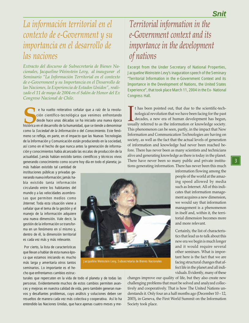
La información territorial en elcontexto de e-Government y suimportancia en el desarrollo delas nacionesExtracto del discurso de Subsecretaria de Bienes Na-cionales, Jacqueline Weinstein Levy, al inaugurar elSeminario “La Información Territorial en el contextode e-Government y su Importancia en el Desarrollo delas Naciones, la Experiencia de Estados Unidos”, reali-zado el 11 de mayo de 2004 en el Salón de Honor del ExCongreso Nacional de Chile.
SnitTerritorial information in thee-Government context and itsimportance in the developmentof nations
Excerpt from the Under Secretary of National Properties,Jacqueline Weinstein Levy’s inaguration speech of the Seminary“Territorial Information in the e-Government Context and itsImportance in the Development of Nations, the United StatesExperience”, that took place March 11, 2004 in the Ex- NationalCongress Hall.
It has been pointed out, that due to the scientific-tech-
nological revolution that we have been facing for the past
decades, a new era of human development has begun,
usually referred to as the information or knowledge society.
This phenomenon can be seen, partly, in the impact that New
Information and Communication Technologies are having on
society, as well as the fact that the actual levels of generation
of information and knowledge had never been reached be-
fore. There has never been as many scientists and technicians
alive and generating knowledge as there is today in the planet.
There have never been so many public and private institu-
tions generating information. There has never been this much
information flowing among the
people of the world at the amaz-
ing speed allowed by media
such as Internet. All of this indi-
cates that information manage-
ment acquires a new dimension,
we would say that information
management is a phenomenon
in itself and, within it, the terri-
torial dimension becomes more
and more relevant.
Certainly, the list of characteris-
tics that lead us to talk about this
new era we begin is much longer
and it would require several
other seminars. What is impor-
tant here is the fact that we are
facing structural changes that af-
fect life in the planet and all indi-
viduals. Evidently, many of these
changes improve our quality of life, but they also create new
challenging problems that must be solved and analyzed collec-
tively and cooperatively. That is how The United Nations un-
derstands it. Only four an a half months ago (December 10 – 12,
2003), in Geneva, the First World Summit on the Information
Society took place.
Snit
3
Se ha vuelto reiterativo señalar que a raíz de la revolu-
ción científico-tecnológica que venimos enfrentandodesde hace unas décadas se ha iniciado una nueva época
histórica en el desarrollo de la humanidad, que se tiende a denominarcomo la Sociedad de la Información o del Conocimiento. Este fenó-meno se refleja, en parte, en el impacto que las Nuevas Tecnologíasde la Información y Comunicación están produciendo en la sociedad,así como en el hecho de que nunca antes la generación de informa-ción y conocimientos había alcanzado las escalas de producción de laactualidad. Jamás habían existido tantos científicos y técnicos vivosgenerando conocimiento como ocurre hoy día en todo el planeta; ja-más habían existido tal cantidad deinstituciones públicas y privadas ge-nerando nueva información; jamás ha-bía existido tanta informacióncirculando entre los habitantes delmundo y a las velocidades asombro-sas que permiten medios comoInternet. Toda esta situación viene aseñalar que el tema de la gestión y elmanejo de la información adquiereuna nueva dimensión. Vale decir, lagestión de la información se transfor-ma en un fenómeno en sí mismo y,dentro de él, la dimensión territoriales cada vez más y más relevante.
Por cierto, la lista de característicasque llevan a hablar de esta nueva épo-ca que estamos iniciando es muchomás larga y ameritaría otros tantosseminarios. Lo importante es el he-cho que enfrentamos cambios estruc-turales que repercuten en la vida de todo el planeta y de todas laspersonas. Evidentemente muchos de estos cambios permiten avan-ces y mejoras en nuestra calidad de vida, pero también generan nue-vos y desafiantes problemas, cuyo análisis y soluciones deben serresueltos de manera cada vez más colectiva y cooperativa. Así lo haentendido las Naciones Unidas, que hace apenas cuatro meses y me-
Jacqueline Weinstein Levy, Subsecretaria de Bienes Nacionales
4
Certainly, if we accept the fact that we are living in a time ofdeep change, we must assume that changes are not usuallyeasy. Even more when they seem to go faster than we wereused to, giving us a feeling of uncertainty, if not confusion.
The people that have lived this process from different directivepositions of public responsibility, like myself, know that toassimilate and use these phenomena for the citizens and society’sbenefit, we must implement new initiatives that can bedeveloped into public policies that will allow us take advantageof the speeding rate of the social transformations that we face.
Initiatives as, for example, the so called Electronic Govern-ment, with all its multiple derivatives, including seminarslike this one.
Initiatives like the one pointed out by the President of theRepublic in the Presidential Instructive Nº 14 of September2001, where he gave to the Chairman of the Committee ofMinisters of the City and the Territory1, the task of creating aNational Territorial Information System, or in a more techni-cal language, the Geo-Spatial Data Infrastructure of Chile.Summarizing, the idea is to implement political, organiza-tional, and technical solutions in a creative manner, so that,every citizen can have access to the territorial informationproduced in the different districts. Information that shouldhelp the territorial impact efficiently and effectively decisionmaking processes. Information to protect our natural re-sources and environment. Information to boost new invest-ments. Information to strengthen democracy anddevelopment in the country.
Of course for all this initiatives to be successful, to reach thefinal goal step by step, hard and steady work is needed. Thisis what we have been doing in the NTIS project for the lasttwo years.
With the contribution of the National Congress, the NationalCongress Library, academic, private, and civil society orga-nizations, last year a proposal was systematized for the Na-tional Territorial Information Policy for the country Based onthis proposal, we are presently working on a law pre-projectto be presented to the President of the Republic that enablesits implementation.
Our goal, is to propose. Legislators have been appointed toapprove these laws, but we, the people involved in thisproject, are presently stressing the great relevance of this is-sue for present and future national development.
Likewise, last year, we started to develop part of the techni-cal solution which will allow access to the existing territorialinformation metadata as well as the metadata that is beingcreated in the country. Though it is only a first step to the useof the full potential new technologies allowed by modern
4
dio (10-12 de diciembre de 2003) desarrolló la Primera Cumbre Mun-dial de la Sociedad de la Información, en la ciudad de Ginebra.
Por cierto, si aceptamos el hecho de que estamos viviendo una épo-ca de cambios profundos, debemos también asumir que muchasveces los cambios no son fáciles, más aún cuando éstos parecen irmás rápido de lo que estábamos acostumbrados, produciendo a ve-ces una sensación de incertidumbre cuando no de confusión.
A quienes nos está tocando vivir este proceso desde distintos car-gos directivos y/o de responsabilidad pública, como es mi caso, sa-bemos que para asimilar de manera correcta estos fenómenos yutilizarlos en beneficio de los ciudadanos y la sociedad en general sedeben implementar nuevas iniciativas que se traduzcan en políticaspúblicas que permitan aprovechar en sentido positivo el ritmo cadavez más acelerado de las transformaciones sociales que se estánviviendo.
Iniciativas, por ejemplo, como la denominada Gobierno Electrónico,con todos sus múltiples derivados, incluyendo seminarios como losde esta mañana.
Iniciativas como la señalada por el Presidente de la República en elInstructivo Presidencial Nº 14 de septiembre de 2001, donde entre-gó al Presidente del Comité de Ministros de la Ciudad y el Territorio1
la tarea de conducir un proceso tendiente a crear un Sistema Nacio-nal de Información Territorial, o si se prefiere hablar en un lenguajemás técnico, la Infraestructura de Datos Geoespaciales de Chile. Ensíntesis, de lo que se trata es de implementar de una manera creativasoluciones políticas, organizacionales y técnicas, para que la infor-mación de nuestro territorio, que se produce y genera en las distin-tas reparticiones públicas, sea accesible para todos los ciudadanos.Información que debe apoyar el proceso de toma de decisiones deimpacto territorial, de manera eficiente y eficaz. Información que pro-teja nuestros recursos y medio ambiente. Información que estimulela generación de nuevas inversiones. Información que fortalezca lademocracia y desarrollo del país.
Por supuesto, para que todas estas iniciativas tengan éxito, se debeimplementar un arduo y constante trabajo que vaya, etapa a etapa,avanzando hasta conseguir el objetivo final. Esto es lo que hemosvenido haciendo los dos últimos años respecto del proyecto SNIT.
1 El presidente del Comité de Ministros de la Ciudad y el Territorio, es el biministro deVivienda y Urbanismo; y de Bienes Nacionales (se trata de dos ministerios distintosdirigidos por un sólo Ministro). La coordinación técnica del proyecto se entregó alMinisterio de Bienes Nacionales.
1 The President of the Committee of Ministers of the City and the Territory, is the biministerof Housing and Urban Planning and National Properties (Two different Ministries underone Minister). The technical coordination is chaired by the Minister of NationalProperties.
Snit
5
Snit
5
El año pasado, con el aporte de representantes del sector público,del Congreso Nacional, de la Biblioteca del Congreso Nacional, delmundo académico, del sector privado y de organizaciones de la so-ciedad civil se pudo sistematizar una propuesta de Política Nacionalde Información Territorial para el país, y sobre esa base se está tra-bajando actualmente en un Anteproyecto de Ley que permita su im-plementación, para ser entregado al Presidente de la República.
Nuestra tarea en este sentido es propositiva; son otros los llamadosa aprobar las leyes, pero lo que estamos haciendo quienes participa-mos de este proceso es señalar que este tema es de la mayor rele-vancia para el actual y futuro desarrollo nacional.
Igualmente, el año pasado comenzamos a implementar parte de lasolución técnica que permita disponer de la metadata de la informa-ción territorial que existe y se crea en el país. Si bien este es sólo unprimer paso tendiente a la utilización de todo el potencial que lasnuevas tecnologías permiten para la gestión moderna de la informa-ción territorial, permitirá enfrentar con optimismo y mayor experien-cia los procesos futuros que se deberán asumir.
También el año pasado iniciamos un intercambio más sistemático deexperiencias en estas materias con otros países del mundo.Específicamente conversamos con el Canadá, así como hoy día con-versaremos con los Estados Unidos y espero que mañana muchosotros países se muestren interesados en establecer un diálogo francoy abierto con nosotros en estas materias y ayudarnos mutuamente.
Lo importante es destacar que cuando planteamos la necesidad decrear un Sistema Nacional de Información Territorial, estamos apun-tando directamente a la modernización de la gestión pública. Se tra-ta de alcanzar una coordinación moderna entre los servicios públicospara materias de información del territorio, así como entre estosservicios y los ciudadanos.
En este sentido, hemos entendido que una coordinación eficiente nosólo permite un mejor uso de los siempre escasos recursos econó-micos, sino que también implica un uso inteligente de estas nuevastecnologías. Y esta coordinación debe ser apoyada por un marcojurídico adecuado que permita y respalde su desarrollo y continui-dad en el tiempo.
Evidentemente estos son problemas relativamente nuevos, lo queimplica, por una parte, que muchas de las respuestas a los desafíosplanteados no existen aún, o que están en formulación, pero lo im-portante es que avancemos en la búsqueda de soluciones. Y, comopor todos es sabido, en este esfuerzo no estamos solos, práctica-mente todos los países del mundo están asumiendo la necesidad decontar con sistemas que permitan una gestión moderna de su infor-mación espacial o territorial. Unos más avanzados que otros, unoscon más recursos económicos que otros, pero finalmente todos par-ticipamos de la idea de poner estas tecnologías al servicio del creci-miento y desarrollo de nuestros pueblos, así como al conocimientoy entendimiento entre los países que integramos este mundo cadavez más globalizado. En este sentido, resulta interesantísimo cono-cer en detalle cuáles son los caminos y enfoques que países comolos Estados Unidos tienen frente a estos temas y espero que estajornada resulte fructífera para todos nosotros.
Muchas Gracias
territorial information management, it will let us face futureprocesses with optimism and greater experience.
Last year, we also began a more systematic exchange of ex-periences in these matters with other countries in the world.We specifically talked with Canada, like we are doing todaywith the United States, and I hope, tomorrow we will do sowith many other countries that show an interest in establish-ing a franc and open dialogue of these matters as well as help-ing one another.
Its important to point out, that when we raise the need tocreate a National Territorial Information System, we are aim-ing directly at public management modernization. It is aboutgetting a modern coordination between public services andterritorial information matters, as well as, between these ser-vices and the citizens.
In this sense, we understand that an efficient coordinationnot only allows a better use of the scarce economic resources,but also, implies a smart use of these new technologies. Thiscoordinating process must be supported by an adequate legalframe which will allow and endorse its development andcontinuity in time.
Evidently, these are relatively new problems, which means,that many of the solutions to the challenges taken do not ex-ist yet or are just being formulated but, what matters is thatwe move towards finding solutions. As it is known, we arenot alone in this effort, practically every country in the worldis assuming the need to rely on systems that enable modernmanagement of spatial or territorial information. Some coun-tries more advanced than others, some with more economicresources than others, but finally, we all share the idea ofputting these technologies to work for the growth and devel-opment of our peoples, as well as, the knowledge and under-standing among the countries that share this increasinglyglobalize world. In this context, it becomes very interestingto see in detail the ways and approaches that countries suchas the United States have to face these issues, and I hope thisseminar will be productive for everyone.
Thank you very much.
6
El Programa Integrado de Gobernabilidad y Des-centralización de la Región de Coquimbo, co-nocido como Más Región, es un proyecto pilotodel Gobierno de Chile, a través del Ministeriode Planificación y Cooperación (MIDEPLAN), yque cuenta con la cooperación de la Unión Eu-ropea. El programa, entre sus líneas de acción,se encuentra desarrollando una Red de Siste-mas de Información Territorial (Red SIT). Estetrabajo surge a partir de una iniciativa de la Se-cretaría Regional de Planificación y Coordina-ción (SERPLAC) de la Región de Coquimbo,radicándose en ésta la coordinación de la RedSIT. Este Sistema de Información opera en tresniveles de la administración pública: Regional, Provincial y Local.Sus objetivos se orientan principalmente en el desarrollo de aplica-ciones basadas en tecnología SIG (Sistemas de Información Geo-gráfica), que contribuyan a fortalecer la gestión pública y proveer deun instrumento que apoye los procesos de toma de decisión en ma-terias de gestión, planificación e inversión pública.
Uno de los aportes importantes del Programa Más Región fueimplementar 10 comunas y la Gobernación Provincial de Choapacon tecnología SIG de última generación; asimismo, desarrollar unproceso de implementación técnico-operativo que consideró la ca-pacitación aplicada en el uso de SIG y GPS (Global PositioningSystem) a los usuarios comunales y provinciales, lo que consideróla asistencia técnica permanente, con el propósito de apoyar los pro-cesos de aprendizaje y minimizar el impacto organizacional. Este pro-ceso fue desarrollado y coordinado desde el Nodo Regional de laRed SIT Coquimbo, que opera en la SERPLAC.
A la fecha, y a pesar del poco tiempo transcurrido, la Red SITCoquimbo ha mostrado un avance y resultado sorprendente, ya que
EXPERIENCIAS REGIONALES REGIONAL EXPERIENCESEn su propósito de difundir experiencias exitosas en el uso de Sistemas de Información Territorial como herramien-tas de apoyo al proceso de toma de decisiones en general, así como a los procesos de ordenamiento territorial, elBoletín SNIT presenta la experiencia que se está implementando en la IV Región de Coquimbo, a través del proyec-to Más Región. Con su implementación, esta región entra al espacio de las más avanzadas del país en la incorpora-ción de nuevas tecnologías y procedimientos de gestión interinstitucional para el tratamiento de la informaciónterritorial. Este esfuerzo se inscribe en el marco del Proyecto de Reforma y Modernización del Estado, particular-mente en lo referido a Gobierno Electrónico.
RED SIT COQUIMBO
“UNA APUESTAREGIONAL PARA ELDESARROLLO LOCAL” .
The Integrated Governability and Decentralization
Program for the Coquimbo Region, known as
More Region, is a try out project of the Govern-
ment of Chile carried out through the Ministry of
Planning and Cooperation (MIDEPLAN) with the
cooperation of the European Union. Among the
activities of the Program, a Territorial Information
System Web is being developed. This work results
from the initiative of the Regional Secretary of
Planning and Coordination (SERPLAC) of the Re-
gion of Coquimbo, where the TIS Web coordina-
tion takes place. This Information System operates
at three levels of the public administration: Regional, Provincial and Local.
Its main objectives are focused on application development based on GIS
(Geographic Information Systems) technology, to contribute to make
public management stronger and provide an instrument that supports
the decision-making processes in public management, planning and
investment matters.
One of the most important contributions of the More Region Program
was to set up ten communes and the Provincial Government of Choapa
with state-of-the-art GIS technology, and also, to develop a technical-op-
erational implementation process that gave applied training in the use of
GIS and GPS (Global Positioning System) to the provincial and commu-
nal users, this included permanent technical assistance, with the objective
of supporting the learning processes and diminishing the organizational
impact. This process was developed and coordinated by the Regional Node
of the Coquimbo TIS Web, which operates in SERPLAC.
With the intention of illustrating our successful experience in the use of the Territorial Information System as asupport tool for the general decision making process, as well as, the territorial ordering process, the NTIS Bulletinpresents the experience that has been implemented through the More Region project in the IV region, Coquimbo.With its implementation, the Coquimbo region enters the most advanced area in the country incorporating interinstitutional management technologies and procedures to the handling of territorial information. This effort is beenframed within of the State Reform and Modernization Project, specifically regarding the Electronic Governmentissues.
TIS WEB COQUIMBO“A REGIONALPROPOSAL TO LOCALDEVELOPMENT”6
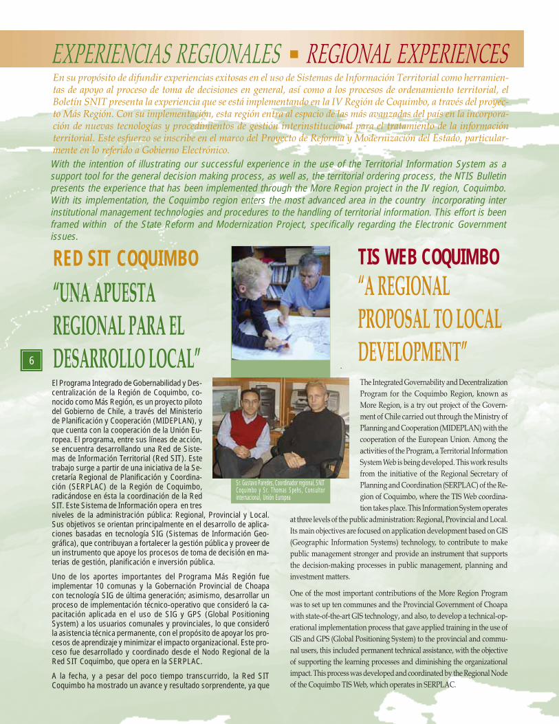
Sr. Gustavo Paredes, Coordinador regional, SNITCoquimbo y Sr. Thomas Spehs, Consultorinternacional, Unión Europea
Snit
7
se han desarrollado una serie de aplicaciones basadas en SIG, de lascuales se pueden mencionar las siguientes: SIGAIP (Sistema de In-formación para la Gestión y el Análisis de la Inversión Pública), elSoftware para la Gestión y el Análisis del Sistema Chile Solidario y elSIT Plan (Herramienta de Análisis de la Inversión Pública Regionalque opera en SERPLAC y en el Consejo Regional). Un hecho impor-tante de destacar es que estas aplicaciones han sido diseñadas ydesarrolladas al interior de la Secretaría Regional de Planificación yCoordinación, mediante el aprovechamiento de los recursos exis-tentes, lo que implica un aprendizaje y capacidad de autogeneraciónde herramientas que potencian la gestión y el uso aplicado de lasNuevas Tecnologías de la Información, lo que sin duda, está contri-buyendo al Proceso de Modernización del Estado.
El responsable de este proyecto es el Sr. Gustavo Paredes Mora, Coor-dinador Regional de la Red SIT Coquimbo y, además, Secretario Téc-nico de la Mesa Regional de Coordinación del Sistema Nacional deInformación Territorial (SNIT). En su opinión, “uno de los desafíosimportantes al momento de diseñar e implementar una solución basa-da en tecnología SIG, que responda a la necesidad de desarrollar he-rramientas que apoyen los procesos de toma decisión, se fundamentaen integrar al proceso a las autoridades regionales, sean éstas: Inten-dente, Consejeros Regionales, SEREMI’s, Gobernadores y Alcaldes,pues en ellos recae la responsabilidad de aprobar y gestionar los pro-yectos y programas que se desarrollan en la Región. Bajo este princi-pio básico la línea de acción se ha orientado principalmente en identificarsus necesidades específicas y, mediante el uso de tecnología SIG, de-sarrollar herramientas personalizadas que faciliten los procesos deanálisis, planificación y gestión territorial.”
Un elemento clave en el diseño y actual desarrollo de la Red SITCoquimbo, ha sido el aporte profesional que ha entregado el ConsultorInternacional Sr. Thomas Spehs quien, en su calidad de asesor técnico,en base a la línea de apoyo de consultores europeos que provee la UniónEuropea para la ejecución del proyecto Más Región, señala que “el SIGcontribuye a sistematizar y estructurar información clave que en granparte ya existe, pero no se está aprovechando de manera ideal. Caberesaltar que el SIG, interpretado de esta manera, no es una herramientaadicional, sino un instrumento para mejorar el flujo de información, tan-to horizontal (dentro de un nivel administrativo) como vertical (entreniveles). Es por ello que se debe insertar cuidadosamente en la estructu-ra institucional existente, de acuerdo con las necesidades reales de losusuarios. Utilizada de esta manera, la herramienta contribuye a mejorary hacer más transparente y eficiente la toma de decisiones, la planifica-ción y la gestión; es por ello que no se debe subestimar el impacto quegenerará en el país disponer de una política consistente para la Gestiónde la Información Territorial”.
Por otra parte, existe consenso entre los profesionales del ProyectoRed SIT Coquimbo en la importancia y trascendencia que tiene elProyecto Sistema Nacional de Información Territorial (SNIT), puesestablece el marco de referencia, no sólo para optimizar el acceso yuso aplicado de la información territorial, sino como un canal válidopara el intercambio de conocimiento entre las diferentes iniciativas,permitiendo de esta manera la replicabilidad y el aprendizaje colecti-vo de las buenas experiencias nacionales.
De igual forma, en opinión del Sr. Paredes,el soporte institucional que brinda el hechode que el SIT esté radicado en la SERPLAC,como representante del Ministerio de Plani-ficación en la Región, permitirá darle una vi-sión a este proyecto de alcance regional ycontribuirá a que el Programa Más Regióncumpla con su rol de aportar propuestas depolítica pública al país, en materia de des-centralización y gestión regional, a través dela experiencia de la instalación del Sistemade Información Territorial.
To the date, in spite of the little time, the Coquimbo TIS Web has shown
amazing progress and results. Several applications based on GIS have
been developed, from which we can mention the following: SIGAIP (Public
Investment Management and Analysis Information System), the software
for the management and analysis of the Chile Solidarity System and the
TIS plan (Regional Public Investment Analysis Information System which
operates in SERPLAC and the Regional Council). It is important to point
out that these applications have been designed and developed within the
Regional Planning and Coordination Secretary by taking advantage of
the existing resources, which implies learning and the ability to self gen-
erate the tools that enhance management and the applied use of New
Information Technologies, which, undoubtedly, is contributing to the
modernizing process of the State.
The responsible for this project is Mr. Gustavo Paredes Mora, Coquimbo
TIS Web regional coordinator and Technical Secretary of the Regional
Coordination Table of the National Territorial Information System (NTIS).
In his opinion, “One of the important challenges, when designing and imple-
menting a solution based on GIS technology to satisfy the need of tool develop-
ment to support the decision making processes, is based on the integration of
regional authorities to the process, these being: Intendants, Regional advisors,
Regional Ministry Secretaries, Governors, and Mayors, because they are respon-
sible for approving and managing the projects and programs that are developed
in the Region. Under this basic principle, the line of action has been mainly ori-
ented towards identifying its specific needs, and by the use of GIS technology,
develop personalized tools to enable the analysis, planning and territorial man-
agement processes.”
A key element in the design and actual development of the Coquimbo
TIS Web, has been the professional contribution of International Consult-
ant. Mr. Thomas Spehs, whom as technical adviser from the group of
European Union consultants for the execution of the More Region project,
points out “the GIS contributes to systematize and structure key information
that, to a great proportion, already exists but that has not been utilized ideally. It
is worth pointing out, that the GIS, interpreted this way is not an additional tool
but, an instrument to improve the flow of information, horizontal (within an
administrative level) as well as vertical (between levels). It is because of this, that
it must be carefully inserted in the existing institutional structure, according to
the real user needs. Used this way, the tool contributes to improve and make
decision making processes, planning, and management more transparent and
efficient. This is why we must not underestimate the impact that having a consis-
tent Policy for Territorial Information Management will have in the country.”
On the other hand, the Coquimbo TIS Web Project professionals agree on
the importance that the National Territorial Information System Project
(NTIS) has because it provides the framework, not only to optimize the
access and applied use of territorial information, but also as a true channel
for the knowledge exchange between the different
initiatives, allowing for the repetition and collective
learning of positive national experiences.
Likewise, in Mr. Paredes’s opinion, the institu-
tional support given by the fact that the NTIS is
at SERPLAC, as a representative of the Ministry
of Planning of the Region, will enable to give a
regional vision to the project and let the More
Region Program achieve its role of creating pro-
posals for public policy for the country on de-
centralization and regional management issues,
by setting up the Territorial Information System.
7
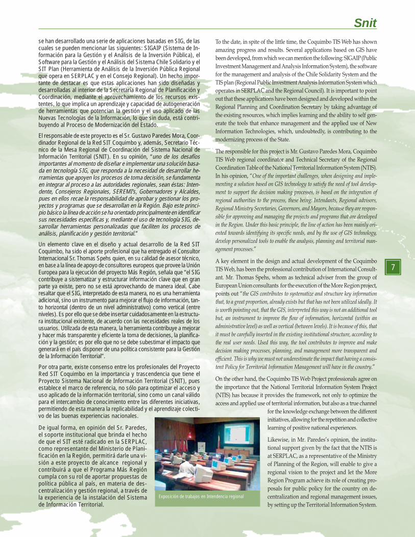
Exposición de trabajos en Intendencia regional
8
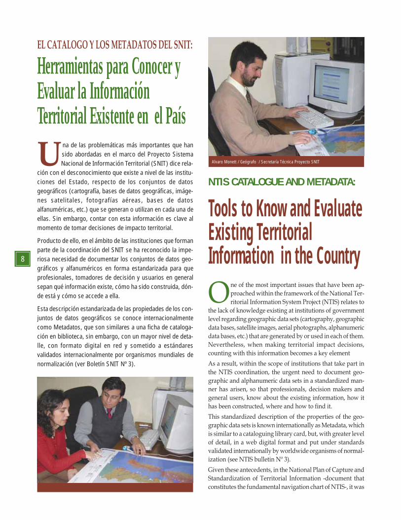
Una de las problemáticas más importantes que han
sido abordadas en el marco del Proyecto Sistema Nacional de Información Territorial (SNIT) dice rela-
ción con el desconocimiento que existe a nivel de las institu-ciones del Estado, respecto de los conjuntos de datosgeográficos (cartografía, bases de datos geográficas, imáge-nes satelitales, fotografías aéreas, bases de datosalfanuméricas, etc.) que se generan o utilizan en cada una deellas. Sin embargo, contar con esta información es clave almomento de tomar decisiones de impacto territorial.
Producto de ello, en el ámbito de las instituciones que formanparte de la coordinación del SNIT se ha reconocido la impe-riosa necesidad de documentar los conjuntos de datos geo-gráficos y alfanuméricos en forma estandarizada para queprofesionales, tomadores de decisión y usuarios en generalsepan qué información existe, cómo ha sido construida, dón-de está y cómo se accede a ella.
Esta descripción estandarizada de las propiedades de los con-juntos de datos geográficos se conoce internacionalmentecomo Metadatos, que son similares a una ficha de cataloga-ción en biblioteca, sin embargo, con un mayor nivel de deta-lle, con formato digital en red y sometido a estándaresvalidados internacionalmente por organismos mundiales denormalización (ver Boletín SNIT Nº 3).
EL CATALOGO Y LOS METADATOS DEL SNIT:
Alvaro Monett / Geógrafo / Secretaría Técnica Proyecto SNIT
One of the most important issues that have been ap-
proached within the framework of the National Ter-
ritorial Information System Project (NTIS) relates to
the lack of knowledge existing at institutions of government
level regarding geographic data sets (cartography, geographic
data bases, satellite images, aerial photographs, alphanumeric
data bases, etc.) that are generated by or used in each of them.
Nevertheless, when making territorial impact decisions,
counting with this information becomes a key element
As a result, within the scope of institutions that take part in
the NTIS coordination, the urgent need to document geo-
graphic and alphanumeric data sets in a standardized man-
ner has arisen, so that professionals, decision makers and
general users, know about the existing information, how it
has been constructed, where and how to find it.
This standardized description of the properties of the geo-
graphic data sets is known internationally as Metadata, which
is similar to a cataloguing library card, but, with greater level
of detail, in a web digital format and put under standards
validated internationally by worldwide organisms of normal-
ization (see NTIS bulletin Nº 3).
Given these antecedents, in the National Plan of Capture and
Standardization of Territorial Information -document that
constitutes the fundamental navigation chart of NTIS-, it was
Tools to Know and EvaluateExisting TerritorialInformation in the Country
Herramientas para Conocer yEvaluar la InformaciónTerritorial Existente en el País
NTIS CATALOGUE AND METADATA:
Snit
9
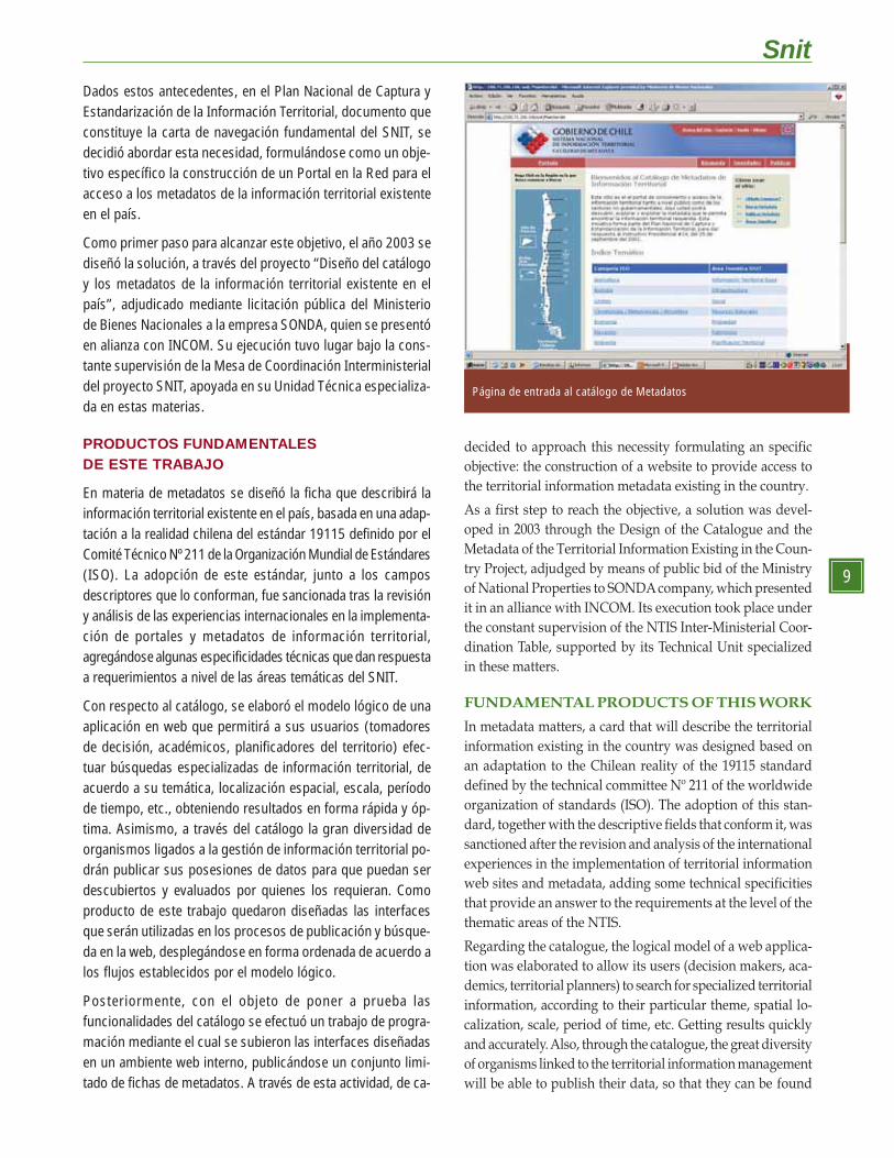
Dados estos antecedentes, en el Plan Nacional de Captura yEstandarización de la Información Territorial, documento queconstituye la carta de navegación fundamental del SNIT, sedecidió abordar esta necesidad, formulándose como un obje-tivo específico la construcción de un Portal en la Red para elacceso a los metadatos de la información territorial existenteen el país.
Como primer paso para alcanzar este objetivo, el año 2003 sediseñó la solución, a través del proyecto “Diseño del catálogoy los metadatos de la información territorial existente en elpaís”, adjudicado mediante licitación pública del Ministeriode Bienes Nacionales a la empresa SONDA, quien se presentóen alianza con INCOM. Su ejecución tuvo lugar bajo la cons-tante supervisión de la Mesa de Coordinación Interministerialdel proyecto SNIT, apoyada en su Unidad Técnica especializa-da en estas materias.
PRODUCTOS FUNDAMENTALESDE ESTE TRABAJO
En materia de metadatos se diseñó la ficha que describirá lainformación territorial existente en el país, basada en una adap-tación a la realidad chilena del estándar 19115 definido por elComité Técnico Nº 211 de la Organización Mundial de Estándares(ISO). La adopción de este estándar, junto a los camposdescriptores que lo conforman, fue sancionada tras la revisióny análisis de las experiencias internacionales en la implementa-ción de portales y metadatos de información territorial,agregándose algunas especificidades técnicas que dan respuestaa requerimientos a nivel de las áreas temáticas del SNIT.
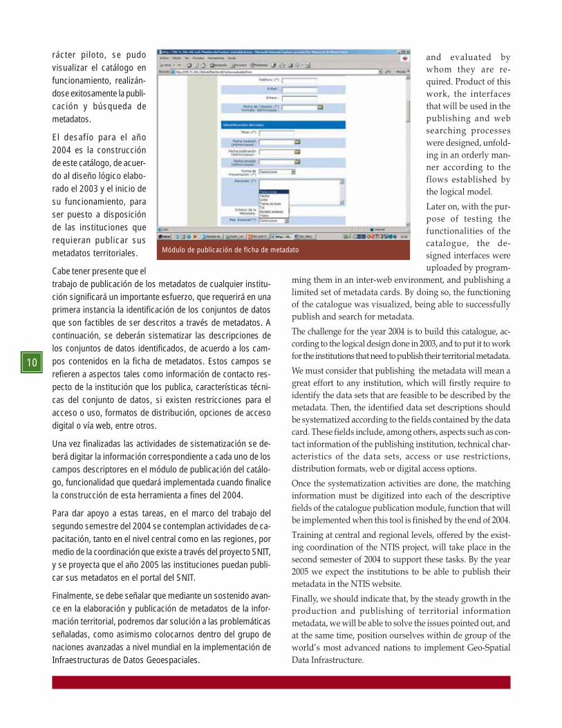
Con respecto al catálogo, se elaboró el modelo lógico de unaaplicación en web que permitirá a sus usuarios (tomadoresde decisión, académicos, planificadores del territorio) efec-tuar búsquedas especializadas de información territorial, deacuerdo a su temática, localización espacial, escala, períodode tiempo, etc., obteniendo resultados en forma rápida y óp-tima. Asimismo, a través del catálogo la gran diversidad deorganismos ligados a la gestión de información territorial po-drán publicar sus posesiones de datos para que puedan serdescubiertos y evaluados por quienes los requieran. Comoproducto de este trabajo quedaron diseñadas las interfacesque serán utilizadas en los procesos de publicación y búsque-da en la web, desplegándose en forma ordenada de acuerdo alos flujos establecidos por el modelo lógico.
Posteriormente, con el objeto de poner a prueba lasfuncionalidades del catálogo se efectuó un trabajo de progra-mación mediante el cual se subieron las interfaces diseñadasen un ambiente web interno, publicándose un conjunto limi-tado de fichas de metadatos. A través de esta actividad, de ca-
decided to approach this necessity formulating an specific
objective: the construction of a website to provide access to
the territorial information metadata existing in the country.
As a first step to reach the objective, a solution was devel-
oped in 2003 through the Design of the Catalogue and the
Metadata of the Territorial Information Existing in the Coun-
try Project, adjudged by means of public bid of the Ministry
of National Properties to SONDA company, which presented
it in an alliance with INCOM. Its execution took place under
the constant supervision of the NTIS Inter-Ministerial Coor-
dination Table, supported by its Technical Unit specialized
in these matters.
FUNDAMENTAL PRODUCTS OF THIS WORK
In metadata matters, a card that will describe the territorial
information existing in the country was designed based on
an adaptation to the Chilean reality of the 19115 standard
defined by the technical committee Nº 211 of the worldwide
organization of standards (ISO). The adoption of this stan-
dard, together with the descriptive fields that conform it, was
sanctioned after the revision and analysis of the international
experiences in the implementation of territorial information
web sites and metadata, adding some technical specificities
that provide an answer to the requirements at the level of the
thematic areas of the NTIS.
Regarding the catalogue, the logical model of a web applica-
tion was elaborated to allow its users (decision makers, aca-
demics, territorial planners) to search for specialized territorial
information, according to their particular theme, spatial lo-
calization, scale, period of time, etc. Getting results quickly
and accurately. Also, through the catalogue, the great diversity
of organisms linked to the territorial information management
will be able to publish their data, so that they can be found
Página de entrada al catálogo de Metadatos
10
rácter piloto, se pudovisualizar el catálogo enfuncionamiento, realizán-dose exitosamente la publi-cación y búsqueda demetadatos.
El desafío para el año2004 es la construcciónde este catálogo, de acuer-do al diseño lógico elabo-rado el 2003 y el inicio desu funcionamiento, paraser puesto a disposiciónde las instituciones querequieran publicar susmetadatos territoriales.
Cabe tener presente que eltrabajo de publicación de los metadatos de cualquier institu-ción significará un importante esfuerzo, que requerirá en unaprimera instancia la identificación de los conjuntos de datosque son factibles de ser descritos a través de metadatos. Acontinuación, se deberán sistematizar las descripciones delos conjuntos de datos identificados, de acuerdo a los cam-pos contenidos en la ficha de metadatos. Estos campos serefieren a aspectos tales como información de contacto res-pecto de la institución que los publica, características técni-cas del conjunto de datos, si existen restricciones para elacceso o uso, formatos de distribución, opciones de accesodigital o vía web, entre otros.
Una vez finalizadas las actividades de sistematización se de-berá digitar la información correspondiente a cada uno de loscampos descriptores en el módulo de publicación del catálo-go, funcionalidad que quedará implementada cuando finalicela construcción de esta herramienta a fines del 2004.
Para dar apoyo a estas tareas, en el marco del trabajo delsegundo semestre del 2004 se contemplan actividades de ca-pacitación, tanto en el nivel central como en las regiones, pormedio de la coordinación que existe a través del proyecto SNIT,y se proyecta que el año 2005 las instituciones puedan publi-car sus metadatos en el portal del SNIT.
Finalmente, se debe señalar que mediante un sostenido avan-ce en la elaboración y publicación de metadatos de la infor-mación territorial, podremos dar solución a las problemáticasseñaladas, como asimismo colocarnos dentro del grupo denaciones avanzadas a nivel mundial en la implementación deInfraestructuras de Datos Geoespaciales.
Módulo de publicación de ficha de metadato
and evaluated by
whom they are re-
quired. Product of this
work, the interfaces
that will be used in the
publishing and web
searching processes
were designed, unfold-
ing in an orderly man-
ner according to the
flows established by
the logical model.
Later on, with the pur-
pose of testing the
functionalities of the
catalogue, the de-
signed interfaces were
uploaded by program-
ming them in an inter-web environment, and publishing a
limited set of metadata cards. By doing so, the functioning
of the catalogue was visualized, being able to successfully
publish and search for metadata.
The challenge for the year 2004 is to build this catalogue, ac-
cording to the logical design done in 2003, and to put it to work
for the institutions that need to publish their territorial metadata.
We must consider that publishing the metadata will mean a
great effort to any institution, which will firstly require to
identify the data sets that are feasible to be described by the
metadata. Then, the identified data set descriptions should
be systematized according to the fields contained by the data
card. These fields include, among others, aspects such as con-
tact information of the publishing institution, technical char-
acteristics of the data sets, access or use restrictions,
distribution formats, web or digital access options.
Once the systematization activities are done, the matching
information must be digitized into each of the descriptive
fields of the catalogue publication module, function that will
be implemented when this tool is finished by the end of 2004.
Training at central and regional levels, offered by the exist-
ing coordination of the NTIS project, will take place in the
second semester of 2004 to support these tasks. By the year
2005 we expect the institutions to be able to publish their
metadata in the NTIS website.
Finally, we should indicate that, by the steady growth in the
production and publishing of territorial information
metadata, we will be able to solve the issues pointed out, and
at the same time, position ourselves within de group of the
world’s most advanced nations to implement Geo-Spatial
Data Infrastructure.
Snit
11
En otras palabras, suacción engloba las po-líticas organizaciona-les, datos, tecnologías,desarrollo de están-dares, mecanismos,recursos humanos yfinancieros necesariospara asegurar que lasactividades y desarro-llos a nivel mundial ylocal logren sus obje-tivos, en beneficio dela sociedad, el medioambiente, el desarro-
llo sustentable de los países en desarrollo, mejoramiento de la calidadde vida y otros tantos aspectos.
Chile, como país, ha participado activamente en las tres últimas re-uniones del GSDI, donde, a través de sus ponencias y exposiciones,ha mostrado los esfuerzos y experiencias nacionales para avanzar ha-cia su propia Infraestructura Nacional de Datos Geoespaciales (INDE)a través del proyecto Sistema Nacional de Información Territorial (SNIT),el que cuenta con el apoyo de dos mandatos presidenciales que avalanla importancia que se le ha dado hasta la fecha a esta iniciativa.
En la última reunión del GSDI, correspondiente a la número 7 (GSDI7),efectuada en Bangalore, India, en el mes de febrero del presenteaño, Chile estuvo representado por el Instituto Geográfico Militar,habiendo desarrollado, entre otras, las siguientes actividades:
CHILE Y LA
INFRAESTRUCTURA
GLOBAL DE DATOS
GEOESPACIALES (GSDI)Subdirección de Ingeniería / Instituto Geográfico Militar
La Infraestructura Global de DatosGeoespaciales, conocida mundialmentecomo GSDI (Global Spatial DataInfrastructure) es una organizacióninternacional que involucra agencias,empresas, personas y firmas a lo largo detodo el mundo, y su objetivo fundamentales apoyar y promover el desarrollo ymantenimiento de las InfraestructurasNacionales de Datos Geoespaciales, comouna efectiva herramienta para una eficientetoma de decisiones a todo nivel.
Snit
Entrega de premio de primer lugar en modalidad poster, a subdirector del IGM TenienteCoronel Rodrigo Barriga
Its fundamental objective is to support and encourage thedevelopment and maintenance of the National Spatial DataInfrastructures as an effective tool for efficient decision-making atall levels. In other words, its activity covers the policies,organizations, data, technologies, development of standards,mechanisms, human and financial resources necessary to ensure thatthe activities and developments at world and local levels reach theirobjectives so as to benefit society, the environment, the sustainabledevelopment of developing countries, improvement of livingstandards and many other aspects.
Chile, as a country, has participated actively in the last three GSDImeetings, where papers and presentations were given in order toshow the efforts made and experiences gained in Chile forprogressing towards its own National Spatial Data Infrastructure(NSDI) by means of the project called the National TerritorialInformation System (NTIS), which is backed by two Presidentialdecrees that confirm the importance given so far to this initiative.
At the last GSDI meeting, the seventh in the series, held in Bangalore,India, in the month of January of this year, Chile was representedby the Military Geographic Institute (IGM), having performed,among other things, the following activities :
• In representation of the Military Geographic Institute,presentations on the topics:
· “The Basic Territorial Information Area, the Chileanperspective on the development of the National Geo-SpatialData Infrastructure”
· “Construction of a Geo-Spatial Database and its integration intothe Geo-Spatial Data Infrastructure Project”
• Participation in the 11th Meeting of the Global Mapping Project.
• Representation of the General Secretary of the Pan-AmericanInstitute for Geography and History (PAIGH) before the GSDIBoard of Directors / Association Council.
Despite the limited representation from Chile, an outstandingparticipation was achieved on being awarded first place in the postercompetition, the topic of the Chilean entry being “Basic TerritorialInformation Area, the Chilean perspective on the development ofthe national geo-spatial data infrastructure”, in which theorganization of the NTIS was graphically displayed, with its thematicareas and the structure and work of the Basic Territorial InformationGroup (GITB in Spanish initials).
Among the conclusions of this meeting, Resolution Nº 13 proposedChile as host country for the 9th International meeting of the GSDI
CHILE AND THEGLOBAL SPATIAL DATAINFRASTRUCTURE(GSDI)
The Global Spatial Data Infrastructure or GSDI is aninternational organization that involves agencies,businesses, people and firms around the world.
11
Engineering Division, Military Geographic Institute
12
• Exponer en representación del Instituto Geográfico Militar (IGM)los temas:
❇ “Área de Información Territorial Básica, la perspectiva chile-na en el desarrollo de la Infraestructura Nacional de DatosGeoespaciales”
❇ “Construcción de una Base de Datos Geoespacial y su inte-gración con el Proyecto de Infraestructura de DatosGeoespaciales”
• Participar en la 11a Reunión del Proyecto Mapa Global.
• Representar al Secretario General del Instituto Panamericano deGeografía e Historia (IPGH) ante en Comité Consultivo del GSDI.
Pese a la poca representación de Chile, éste tuvo una destacada par-ticipación al ser reconocido con el primer lugar en la modalidad pós-ter, con el tema “Área de Información territorial Básica, la perspectivachilena en el desarrollo de la infraestructura nacional de datosgeoespaciales”, donde se mostró de manera gráfica la organizacióndel SNIT, sus áreas temáticas y la estructura y trabajo del Grupo deInformación Territorial Básica (GITB).
Dentro de las conclusiones de esta reunión, en su Resolución Nº 13,se propuso a Chile como país sede de la 9a reunión Internacional delGSDI en el año 2006, lo que constituye un gran reconocimiento yestímulo al trabajo desarrollado por el país a través del SNIT y elIGM, para avanzar hacia la materialización de su Infraestructura Na-cional de Datos Geoespaciales.
Ante esta gran responsabilidad, de constituirse en país sede del GSDI9el año 2006, desde ya se realizan las coordinaciones y reuniones, paramaterializar este importante evento internacional, con el apoyo de latotalidad de los miembros del SNIT.
in the year 2006, which constitutes a major recognition andencouragement for the work being done for the country throughthe NTIS and the IGM, in order to make progress towards thecreation of its National Geo-Spatial Data Infrastructure.
Facing this great responsibility of being host country for GSDI9 inthe year 2006, from now onwards the coordination and meetingsare being carried out in order to carry out this important internationalevent, with the support of all the members of the NTIS.
Subdirección de Ingeniería, Instituto Geográfico Militar
1. EL MAPA GLOBAL EN EL MUNDO
El Proyecto Mapa Global obedece a una iniciativa consti-tuida el año 1996, cuyo objetivo final es la materializa-ción y divulgación de una serie de cubiertas cartográficasdigitales a escala chica (1:1.000.000). Coordinado y di-rigido por el Comité Internacional Directivo del Mapa Glo-bal (International Steering Committee for Global Mapping-ISCGM-), está estrechamente ligado con las iniciativasde las Infraestructuras de Datos Geoespaciales del mun-do. En el año 1998 se publicaron las EspecificacionesTécnicas y se inició la producción de la primera versióndel Mapa Global.
Desde 2000 el ISCGM ha difundido el primer Mapa Global, la ‘Versión Cero’(V.0) a través de su sitio web, ubicado en www.iscgm.org. Basada en mate-rial proporcionado por las agencias USGS y NGIA de los Estados Unidos, laV.0 es, sin embargo, una versión preliminar, destinada a ser progresivamen-te reemplazada o actualizada por las contribuciones a la Versión Uno (V.1).La V.1 ya cuenta con material proporcionado por 18 países, publicado en elsitio web. El ISCGM está revisando y convirtiendo material recibido de aproxi-madamente 28 países más (incluyendo Chile), y un número similar de paí-ses están actualmente preparando material. Está previsto que la V.1 será
EL PROYECTO “MAPA GLOBAL” THE “GLOBAL MAPPING” PROJECTEngineering Division, Military Geographic Institute
1. THE GLOBAL MAP
The Global Mapping Project started with aninitiative formalized as from 1996, its finalobjective is to create and distribute a series ofcartographic coverages at small scale(1:1,000,000). Coordinated and directed by theInternational Steering Committee for GlobalMapping –ISCGM-, it is closely linked to the Geo-Spatial Data Infrastructure initiatives around theworld. In the year 1998 the TechnicalSpecifications were published and productionbegan on the first version of the Global Map.
Since 2000 the ISCGM has made available the firstGlobal Map, ‘Version Zero’ (V.0) through its web site at www.iscgm.org.Based on data provided by the USGS and NGIA agencies in the UnitedStates, V.0 is nevertheless a preliminary version, intended to beprogressively replaced or updated by the contributions to VersionOne (V.1), which already contains data from 18 countries publishedon the web site. The ISCGM is assessing and converting materialreceived from about another 28 countries (including Chile), and a si-milar number of countries are currently preparing material. It isexpected that V.1 be completed by the year 2007. There are plans fora Version Two, under modified technical specifications.
Snit
13
completada para el año 2007. Existen planes para una Versión Dos, bajoespecificaciones técnicas modificadas.
2. ESTRUCTURA DEL MAPA GLOBAL
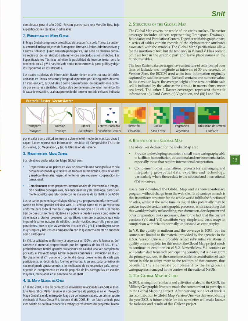
El Mapa Global comprende la totalidad de la superficie de la Tierra. La cubier-ta vectorial incluye objetos de Transporte, Drenaje, Límites Administrativos yCentros Poblados. Junto con esta parte gráfica, una serie de planillas contie-ne registros de los atributos alfanuméricos asociados a los símbolos. LasEspecificaciones Técnicas admiten la posibilidad de insertar texto, pero latendencia en V.0 y V.1 ha sido la de omitir todo texto en la parte gráfica y dejarlos topónimos en los atributos.
Las cuatro cubiertas de información Raster tienen una estructura de celdasubicadas en líneas de latitud y longitud separadas por 30 segundos de arco.En Versión Cero, ISCGM utilizó como base información originalmente capta-da por sensores satelitales. Cada celda contiene un solo valor numérico. Enla capa de elevación, la altura promedio del terreno en cada celda es indicada
por el valor como altitud en metros sobre el nivel medio del mar. Las otras 3capas Raster representan información temática: (i) Composición Física delos Suelos, (ii) Vegetación, y (iii) la Utilización de Terreno.
3. BENEFICIOS DEL MAPA GLOBAL
Los objetivos declarados del Mapa Global son:
• Proporcionar a los países en vías de desarrollo una cartografía a escalapequeña adecuada que facilite los trabajos humanitarios, educacionalesy medioambientales, especialmente los que requieren cooperación in-ternacional.
• Complementar otros proyectos internacionales de intercambio e integra-ción de datos geoespaciales, de conocimientos y de tecnología, particular-mente aquellos que relacionan con las iniciativas de los INDE y del GSDI.
Los usuarios pueden bajar el Mapa Global y su programa interfaz de visuali-zación en forma gratuita del sitio web. Su ventaja como tal es su estructurauniforme para todo el mundo, cumpliendo la función de un atlas, al mismotiempo que sus archivos digitales en potencia pueden servir como materialde entrada a ciertos procesos cartográficos, siempre aceptando que estoimpondría varios trabajos de edición, transformación, desarrollo y otras pre-paraciones, puesto que las versiones actuales (V.0 y V.1) constituyen cartasmuy simples y básicas en comparación con lo que normalmente se entiendecomo cartografía.
En V.0, la calidad es uniforme y la cobertura es 100%, pero la fuente es úni-camente el material proporcionado por las agencias de los EE.UU.. El V.1probablemente tendrá grandes variaciones de calidad una vez completado;por esto, el Proyecto Mapa Global requiere continuar su evolución en el V.2.No obstante, el V.1 contiene o contendrá datos provenientes de cada paísparticipante, es decir, de las fuentes primarias. A su vez, cada contribuciónnacional puede ajustarse más a las realidades de su respectivo país, consti-tuyendo el complemento en escala pequeña de las cartografías en escalasmayores, manejadas en el contexto de los INDE.
4. EL MAPA GLOBAL DE CHILE
En el año 2001, a raíz de contactos y actividades relacionadas al GSDI, el Insti-tuto Geográfico Militar asumió el compromiso de participar en el ProyectoMapa Global, siendo entregado, luego de un intenso trabajo, un primer aportedestinado al Mapa Global V.1, durante el año 2003. En un futuro artículo paraeste boletín se darán a conocer los trabajos y resultados del proyecto Chileno.
Snit
13
2. STRUCTURE OF THE GLOBAL MAP
The Global Map covers the whole of the earths surface. The vectorcoverage includes objects representing Transport, Drainage,Boundaries and Population Centers. Together with this graphic part,a series of tables contain records of the alphanumeric attributesassociated with the symbols. The Global Map Specifications allowfor the insertion of text, but the tendency in V.0 and V.1 has been toomit all text in the graphic part and leave place names in theattributes tables.
The four Raster data coverages have a structure of cells located overlines of latitude and longitude at intervals of 30 arc seconds. InVersion Zero, the ISCGM used as its base information originallycaptured by satellite sensors. Each cell contains one numeric value.In the elevation layer, the average height of the terrain within eachcell is indicated by the value as the altitude in meters above meansea level. The other 3 Raster coverages represent thematicinformation : (i) Land Cover, (ii) Vegetation, and (iii) Land Use.
3. BENEFITS OF THE GLOBAL MAP
The objectives declared for the Global Map are :
• Provide to developing countries a small-scale cartography ableto facilitate humanitarian, educational and environmental tasks,especially those that require international cooperation.
• Complement other international projects for exchanging andintegrating geo-spatial data, expertise and technology,particularly where these relate to the national and international
SDI initiatives.
Users can download the Global Map and its viewer-interfaceprogram without charge from the web site. Its advantage as such isthat its uniform structure for the whole world fulfils the function ofan atlas, whilst at the same time its digital files potentially may beused as input to certain cartographic processes, whilst accepting thatthis would probably make editing, transformation, development andother preparation tasks necessary, due to the fact that the currentversions (V.0 and V.1) constitute very simple and basic maps incomparison with what is normally understood as cartography.
In V.0, the quality is uniform and the coverage is 100%, but thesources are limited to the material provided by the agencies in theU.S.A. Version One will probably reflect substantial variations inquality once complete; for this reason the Global Map project needsto continue its evolution en el V.2. Nevertheless, V.1 contains orwill contain data from each participating country, that is to say, fromthe primary sources. At the same time, each the contribution of eachnation is able to adapt more to the realities of that country, thusbecoming the small-scale complement to the larger-scalecartographies managed in the context of the national NSDIs.
4. THE GLOBAL MAP OF CHILE
In 2001, arising from contacts and activities related to the GSDI, theMilitary Geographic Institute made the commitment to participatein the Global Mapping Project. After carrying out a lot of work, afirst contribution to Global Map Version One was delivered duringthe year 2003. A future article for this newsletter will make knownthe tasks for and results of this Chilean project.
Transporte Drenaje Límites Centros Poblados Elevación Suelos Vegetación Utilización de Terreno
Transport Drainage Boundaries Population Centers Elevation Land Cover Vegetation Land Use
Vectorial Raster Vector Raster
14
LA EXPERIENCIA CANADIENSE
EXPERTOS INTERNACIONALES EXPONEN EN CHILE / INTERNATIONAL EXPERTS IN CHILE
In an effort to integrate the Chilean NationalTerritorial Information System to the inter-national community of Geo-Spatial Data In-frastructures, the seminar “The Information So-ciety and the construction of Territorial Informa-tion Systems: the Canadian experience”, tookplace in November 2003. The objective wasto present the experience of this country,known for its world-wide leadership inimplementing solutions related to manage-ment and access to territorial information.
The event, summoned by the Ministry ofNational Properties and the CanadianEmbassy, was inaugurated by former UnderSecretary Paulina Saball Astaburuaga andAndree Vary, Counselor of Commercial andEconomic Issues of the Canadian Embassy.
The Canadian delegation was formed byPh.D. Bob O’Neil, director of the CanadianCenter of Remote Perception, responsible forthe Geoconnections Program; Ph.D. MaryOgilvie, Vice President of the Center forProperty Studies of the University of NewBrunswick; Ph.D. Sue Nichols of the Geodesyand Geomatic Department of the Universityof New Brunswick (UNB) and Mr. EdKennedy, Director of the Center of Geoprojectsof Canada and President of the Associationof Geomatic Industrials of Canada.
In his presentation, Dr. O’Neil pointed outthat the Goeconnections Program belongs toa national initiative to develop Canada’s geo-spatial data infrastructure, being its mainobjective the provision of Internet access tothe geographical or territorial informationgenerated by the many Ministries and pub-lic offices in that country. Also to facilitatedata integration and standardization, newtechnologies promotion and expand the usesand applications of geosapatial information.
Today, this program involves 1,962 organizations and, together withpublic institutions, has included, among others, the industry, academicorganizations, nongovernmental organisms, constituting the so callednational geo-spatial data community of Canada.
Representing the private sector, Mr. Kennedy, whom is also Presidentof the Canadian Association of the Geomatic Industry, said that thereis a strong alliance in his country between the Government and theprivate sector for geomatic development. In this sense, the governmenthas contributed to the growth of the industry by conducting researchand transferring technology, outsourcing and supporting business de-velopment at an international level.
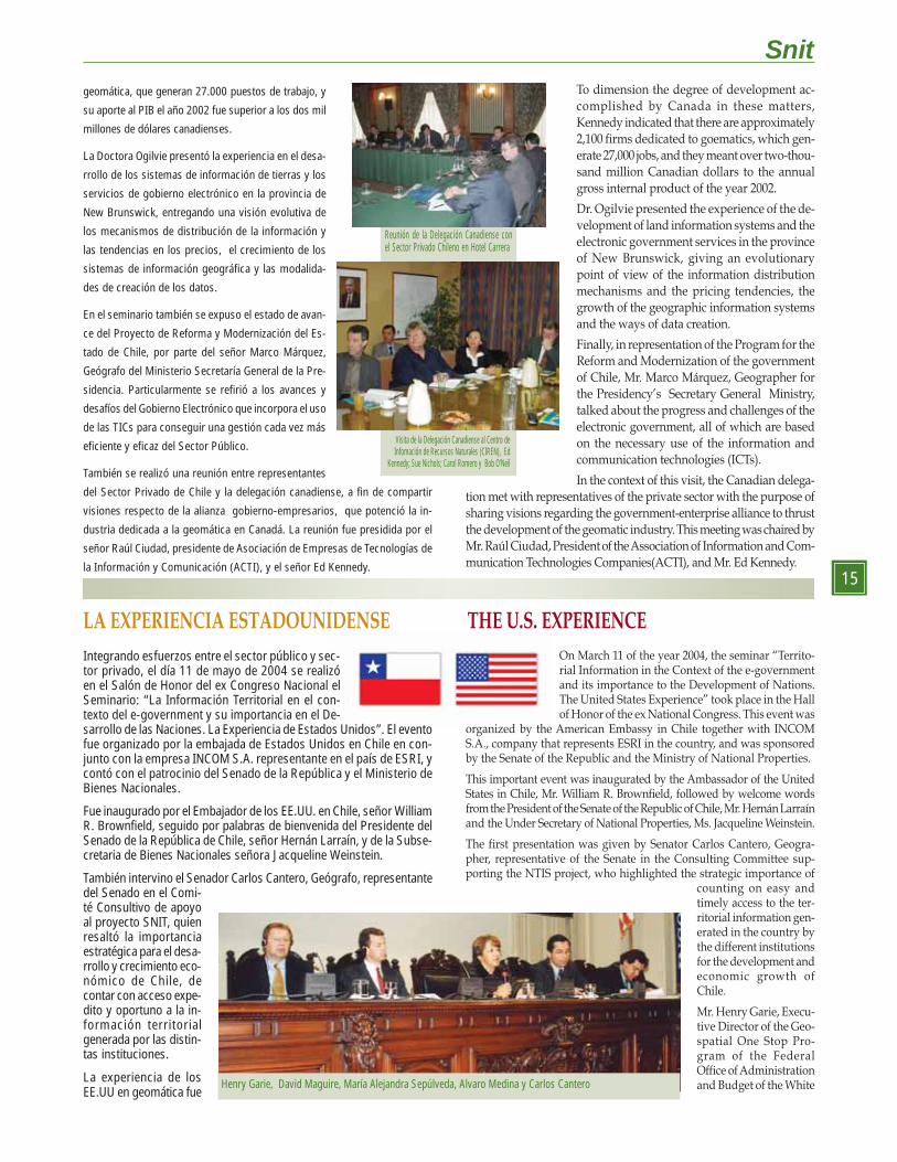
En un esfuerzo de integración del Sistema Nacional de
Información Territorial de Chile con la comunidad inter-
nacional de Infraestructuras de Datos Geoespaciales, se
realizó en noviembre de 2003 el seminario “La Sociedad
de la Información y la Construcción de los Sistemas de
Información Territorial: la experiencia de Canadá”. El ob-
jetivo fue compartir la experiencia de ese país, conocido
mundialmente por su elevado desarrollo en geomática y
sus aplicaciones a las tareas de gestión.
El evento, convocado por el Ministerio de Bienes Nacio-
nales y la embajada de Canadá fue inaugurado por la
entonces Ministra(s) de dicha cartera, Paulina Saball
Astaburuaga y Andree Vary, Consejera de Asuntos Co-
merciales y Económicos de la Embajada de Canadá en
Chile.
La delegación canadiense estuvo integrada por el Doc-
tor Bob O’Neil, director del Centro Canadiense de
Percepción Remota, responsable del Programa
Geoconnections; la Doctora Mary Ogilvie, Vicepresidenta
del Centro de Estudios de la Propiedad de la Universidad
de New Brunswick; la Doctora Sue Nichols del Departa-
mento de Geodesia y Geomática de la Universidad de
New Brunswick (UNB); el señor Ed Kennedy, director del
Centro de Geoproyectos de Canadá y presidente de la
Asociación de Industriales de Geomática de Canadá.
El Doctor O’Neil señaló que el Programa Geoconnections
es una iniciativa nacional para desarrollar la infraestruc-
tura de datos geoespaciales de Canadá. Entre sus objeti-
vos busca hacer accesible a través de Internet la
información geográfica generada por los ministerios y
oficinas públicas; facilitar la integración y estandarización
de los datos, promover el desarrollo de tecnologías
innovadoras y expandir el uso y aplicaciones de la in-
formación geoespacial.
El programa involucra a 1.962 organizaciones, e incluye a sectores de la in-
dustria, academia y organismos no gubernamentales, constituyendo la Co-munidad Nacional de Datos Geoespaciales de Canadá.
El representante del sector privado, señor Kennedy (presidente de la Asociación
Canadiense de la Industria Geomática), expuso sobre la alianza gobierno-sector
privado para el desarrollo de la geomática. El gobierno ha contribuido al creci-miento de la industria mediante la conducción de la investigación y la transferen-
cia de tecnología, contratando el trabajo y dando soporte al desarrollo de negocios
a nivel internacional. Existen aproximadamente 2.100 firmas dedicadas a la
El SNIT Establece un Diálogo con sus pares de América del Norte: Geoconnections Program y Geospatial One StopSNIT Establishes a Dialogue with its pairs of North America: Geoconnections Program and Geospatial One Stop
THE CANADIAN EXPERIENCE
Reunión de la Delegación Canadiense conla ex Subsecretaria de Bienes Nacionales,Sra. Paulina Saball Astaburuaga, y Alvaro MedinaAravena, Secretario Técnico del SNIT.
Andree Vary, Consejera de AsuntosComerciales y Económicos de la Embajada
de Canadá, Margot Edwards, AgenteComercial de la Embajada de Canadá, Paulina Saball
Astaburuaga, ex Subsecretariadel Ministerio de Bienes Nacionales
Jornada de Seminario en el HotelCarrera. Santiago de Chile.
Snit
15
LA EXPERIENCIA ESTADOUNIDENSE
On March 11 of the year 2004, the seminar “Territo-rial Information in the Context of the e-governmentand its importance to the Development of Nations.The United States Experience” took place in the Hallof Honor of the ex National Congress. This event was
organized by the American Embassy in Chile together with INCOMS.A., company that represents ESRI in the country, and was sponsoredby the Senate of the Republic and the Ministry of National Properties.
This important event was inaugurated by the Ambassador of the UnitedStates in Chile, Mr. William R. Brownfield, followed by welcome wordsfrom the President of the Senate of the Republic of Chile, Mr. Hernán Larraínand the Under Secretary of National Properties, Ms. Jacqueline Weinstein.
The first presentation was given by Senator Carlos Cantero, Geogra-pher, representative of the Senate in the Consulting Committee sup-porting the NTIS project, who highlighted the strategic importance of
counting on easy andtimely access to the ter-ritorial information gen-erated in the country bythe different institutionsfor the development andeconomic growth ofChile.
Mr. Henry Garie, Execu-tive Director of the Geo-spatial One Stop Pro-gram of the FederalOffice of Administrationand Budget of the White
THE U.S. EXPERIENCE
geomática, que generan 27.000 puestos de trabajo, y
su aporte al PIB el año 2002 fue superior a los dos mil
millones de dólares canadienses.
La Doctora Ogilvie presentó la experiencia en el desa-
rrollo de los sistemas de información de tierras y los
servicios de gobierno electrónico en la provincia de
New Brunswick, entregando una visión evolutiva de
los mecanismos de distribución de la información y
las tendencias en los precios, el crecimiento de los
sistemas de información geográfica y las modalida-
des de creación de los datos.
En el seminario también se expuso el estado de avan-
ce del Proyecto de Reforma y Modernización del Es-
tado de Chile, por parte del señor Marco Márquez,
Geógrafo del Ministerio Secretaría General de la Pre-
sidencia. Particularmente se refirió a los avances y
desafíos del Gobierno Electrónico que incorpora el uso
de las TICs para conseguir una gestión cada vez más
eficiente y eficaz del Sector Público.
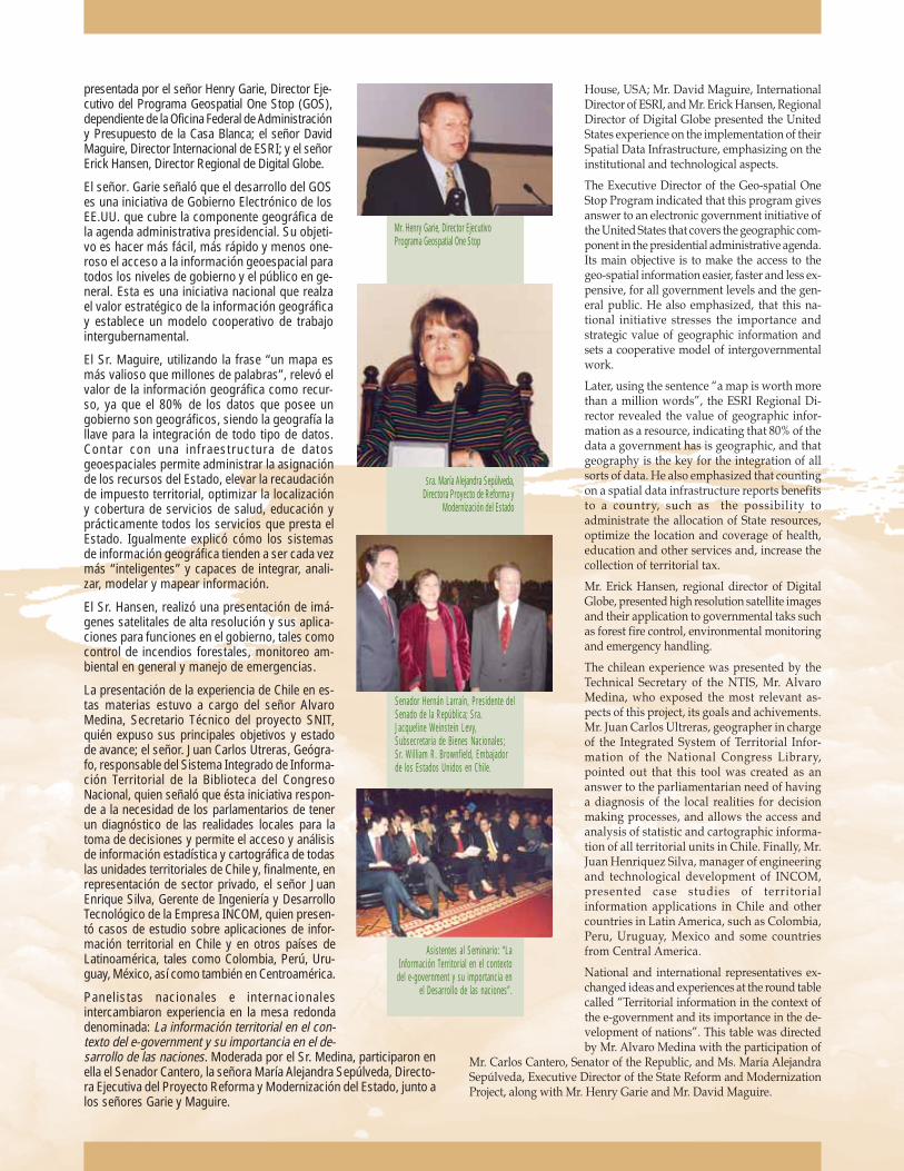
También se realizó una reunión entre representantes
del Sector Privado de Chile y la delegación canadiense, a fin de compartir
visiones respecto de la alianza gobierno-empresarios, que potenció la in-
dustria dedicada a la geomática en Canadá. La reunión fue presidida por el
señor Raúl Ciudad, presidente de Asociación de Empresas de Tecnologías de
la Información y Comunicación (ACTI), y el señor Ed Kennedy.
Integrando esfuerzos entre el sector público y sec-tor privado, el día 11 de mayo de 2004 se realizóen el Salón de Honor del ex Congreso Nacional elSeminario: “La Información Territorial en el con-texto del e-government y su importancia en el De-sarrollo de las Naciones. La Experiencia de Estados Unidos”. El eventofue organizado por la embajada de Estados Unidos en Chile en con-junto con la empresa INCOM S.A. representante en el país de ESRI, ycontó con el patrocinio del Senado de la República y el Ministerio deBienes Nacionales.
Fue inaugurado por el Embajador de los EE.UU. en Chile, señor WilliamR. Brownfield, seguido por palabras de bienvenida del Presidente delSenado de la República de Chile, señor Hernán Larraín, y de la Subse-cretaria de Bienes Nacionales señora Jacqueline Weinstein.
También intervino el Senador Carlos Cantero, Geógrafo, representantedel Senado en el Comi-té Consultivo de apoyoal proyecto SNIT, quienresaltó la importanciaestratégica para el desa-rrollo y crecimiento eco-nómico de Chile, decontar con acceso expe-dito y oportuno a la in-formación territorialgenerada por las distin-tas instituciones.
La experiencia de losEE.UU en geomática fue
Reunión de la Delegación Canadiense conel Sector Privado Chileno en Hotel Carrera
Visita de la Delegación Canadiense al Centro deInfomación de Recursos Naturales (CIREN), Ed
Kennedy; Sue Nichols; Carol Romero y Bob O’Neil
Henry Garie, David Maguire, María Alejandra Sepúlveda, Alvaro Medina y Carlos Cantero
To dimension the degree of development ac-complished by Canada in these matters,Kennedy indicated that there are approximately2,100 firms dedicated to goematics, which gen-erate 27,000 jobs, and they meant over two-thou-sand million Canadian dollars to the annualgross internal product of the year 2002.
Dr. Ogilvie presented the experience of the de-velopment of land information systems and theelectronic government services in the provinceof New Brunswick, giving an evolutionarypoint of view of the information distributionmechanisms and the pricing tendencies, thegrowth of the geographic information systemsand the ways of data creation.
Finally, in representation of the Program for theReform and Modernization of the governmentof Chile, Mr. Marco Márquez, Geographer forthe Presidency’s Secretary General Ministry,talked about the progress and challenges of theelectronic government, all of which are basedon the necessary use of the information andcommunication technologies (ICTs).
In the context of this visit, the Canadian delega-tion met with representatives of the private sector with the purpose ofsharing visions regarding the government-enterprise alliance to thrustthe development of the geomatic industry. This meeting was chaired byMr. Raúl Ciudad, President of the Association of Information and Com-munication Technologies Companies(ACTI), and Mr. Ed Kennedy.
House, USA; Mr. David Maguire, InternationalDirector of ESRI, and Mr. Erick Hansen, RegionalDirector of Digital Globe presented the UnitedStates experience on the implementation of theirSpatial Data Infrastructure, emphasizing on theinstitutional and technological aspects.
The Executive Director of the Geo-spatial OneStop Program indicated that this program givesanswer to an electronic government initiative ofthe United States that covers the geographic com-ponent in the presidential administrative agenda.Its main objective is to make the access to thegeo-spatial information easier, faster and less ex-pensive, for all government levels and the gen-eral public. He also emphasized, that this na-tional initiative stresses the importance andstrategic value of geographic information andsets a cooperative model of intergovernmentalwork.
Later, using the sentence “a map is worth morethan a million words”, the ESRI Regional Di-rector revealed the value of geographic infor-mation as a resource, indicating that 80% of thedata a government has is geographic, and thatgeography is the key for the integration of allsorts of data. He also emphasized that countingon a spatial data infrastructure reports benefitsto a country, such as the possibility toadministrate the allocation of State resources,optimize the location and coverage of health,education and other services and, increase thecollection of territorial tax.
Mr. Erick Hansen, regional director of DigitalGlobe, presented high resolution satellite imagesand their application to governmental taks suchas forest fire control, environmental monitoringand emergency handling.
The chilean experience was presented by theTechnical Secretary of the NTIS, Mr. AlvaroMedina, who exposed the most relevant as-pects of this project, its goals and achivements.Mr. Juan Carlos Ultreras, geographer in chargeof the Integrated System of Territorial Infor-mation of the National Congress Library,pointed out that this tool was created as ananswer to the parliamentarian need of havinga diagnosis of the local realities for decisionmaking processes, and allows the access andanalysis of statistic and cartographic informa-tion of all territorial units in Chile. Finally, Mr.Juan Henriquez Silva, manager of engineeringand technological development of INCOM,presented case studies of territorialinformation applications in Chile and othercountries in Latin America, such as Colombia,Peru, Uruguay, Mexico and some countriesfrom Central America.
National and international representatives ex-changed ideas and experiences at the round tablecalled “Territorial information in the context ofthe e-government and its importance in the de-velopment of nations”. This table was directedby Mr. Alvaro Medina with the participation of
Mr. Carlos Cantero, Senator of the Republic, and Ms. Maria AlejandraSepúlveda, Executive Director of the State Reform and ModernizationProject, along with Mr. Henry Garie and Mr. David Maguire.
Senador Hernán Larraín, Presidente delSenado de la República; Sra.Jacqueline Weinstein Levy,Subsecretaria de Bienes Nacionales;Sr. William R. Brownfield, Embajadorde los Estados Unidos en Chile.
presentada por el señor Henry Garie, Director Eje-cutivo del Programa Geospatial One Stop (GOS),dependiente de la Oficina Federal de Administracióny Presupuesto de la Casa Blanca; el señor DavidMaguire, Director Internacional de ESRI; y el señorErick Hansen, Director Regional de Digital Globe.
El señor. Garie señaló que el desarrollo del GOSes una iniciativa de Gobierno Electrónico de losEE.UU. que cubre la componente geográfica dela agenda administrativa presidencial. Su objeti-vo es hacer más fácil, más rápido y menos one-roso el acceso a la información geoespacial paratodos los niveles de gobierno y el público en ge-neral. Esta es una iniciativa nacional que realzael valor estratégico de la información geográficay establece un modelo cooperativo de trabajointergubernamental.
El Sr. Maguire, utilizando la frase “un mapa esmás valioso que millones de palabras”, relevó elvalor de la información geográfica como recur-so, ya que el 80% de los datos que posee ungobierno son geográficos, siendo la geografía lallave para la integración de todo tipo de datos.Contar con una infraestructura de datosgeoespaciales permite administrar la asignaciónde los recursos del Estado, elevar la recaudaciónde impuesto territorial, optimizar la localizacióny cobertura de servicios de salud, educación yprácticamente todos los servicios que presta elEstado. Igualmente explicó cómo los sistemasde información geográfica tienden a ser cada vezmás “inteligentes” y capaces de integrar, anali-zar, modelar y mapear información.
El Sr. Hansen, realizó una presentación de imá-genes satelitales de alta resolución y sus aplica-ciones para funciones en el gobierno, tales comocontrol de incendios forestales, monitoreo am-biental en general y manejo de emergencias.
La presentación de la experiencia de Chile en es-tas materias estuvo a cargo del señor AlvaroMedina, Secretario Técnico del proyecto SNIT,quién expuso sus principales objetivos y estadode avance; el señor. Juan Carlos Utreras, Geógra-fo, responsable del Sistema Integrado de Informa-ción Territorial de la Biblioteca del CongresoNacional, quien señaló que ésta iniciativa respon-de a la necesidad de los parlamentarios de tenerun diagnóstico de las realidades locales para latoma de decisiones y permite el acceso y análisisde información estadística y cartográfica de todaslas unidades territoriales de Chile y, finalmente, enrepresentación de sector privado, el señor JuanEnrique Silva, Gerente de Ingeniería y DesarrolloTecnológico de la Empresa INCOM, quien presen-tó casos de estudio sobre aplicaciones de infor-mación territorial en Chile y en otros países deLatinoamérica, tales como Colombia, Perú, Uru-guay, México, así como también en Centroamérica.
Panelistas nacionales e internacionalesintercambiaron experiencia en la mesa redondadenominada: La información territorial en el con-texto del e-government y su importancia en el de-sarrollo de las naciones. Moderada por el Sr. Medina, participaron enella el Senador Cantero, la señora María Alejandra Sepúlveda, Directo-ra Ejecutiva del Proyecto Reforma y Modernización del Estado, junto alos señores Garie y Maguire.
Mr. Henry Garie, Director EjecutivoPrograma Geospatial One Stop
Sra. María Alejandra Sepúlveda,Directora Proyecto de Reforma y
Modernización del Estado
Asistentes al Seminario: “LaInformación Territorial en el contexto
del e-government y su importancia enel Desarrollo de las naciones”.